Method
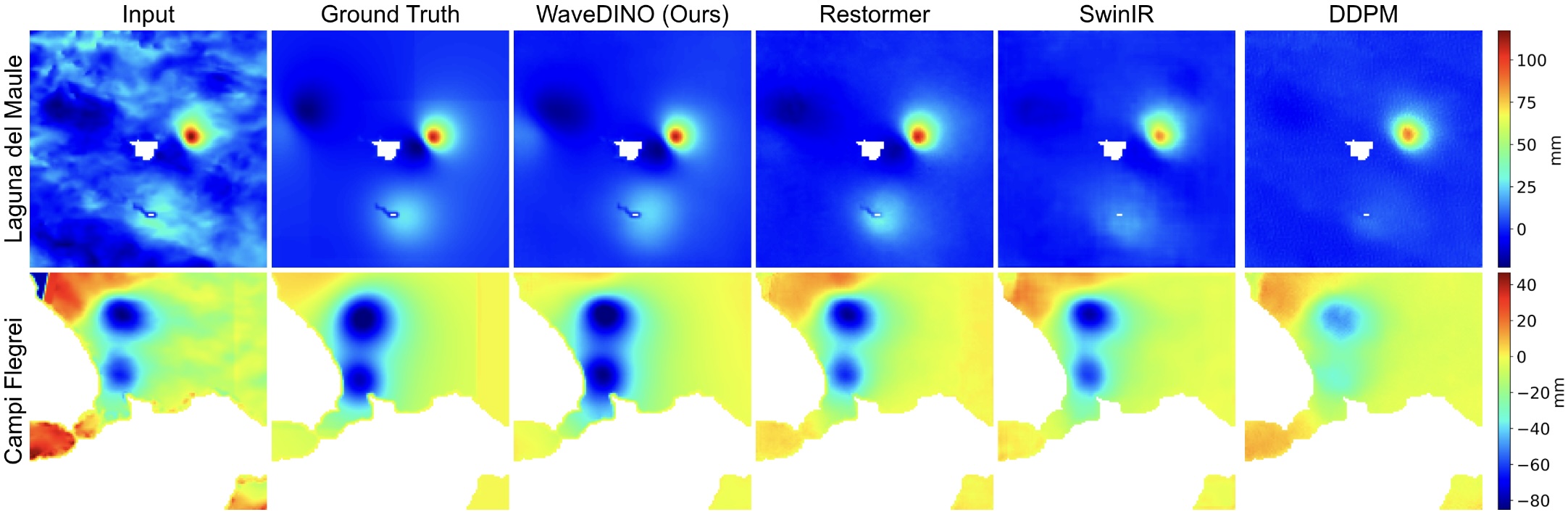
WaveDINO is a wavelet-based multi-scale denoiser that explicitly targets the spatially coherent, non-stationary statistics of tropospheric phase delay. The input unwrapped phase is decomposed into multi-resolution sub-bands so that broad atmospheric components can be modelled primarily in the low-frequency pathway, while fine deformation-related structure is preserved through high-frequency skip connections. Encoder channels follow 32 → 64 → 128, with the decoder mirrored.
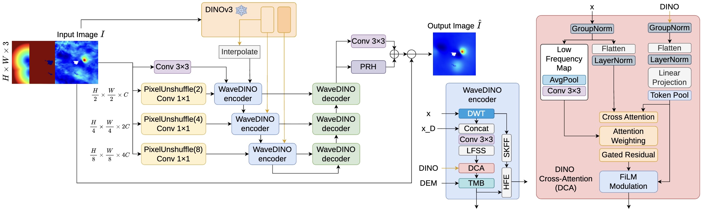
DINOv3 Cross-Attention (DCA)
Fuses frozen DINOv3 ConvNeXt-Base features with the model's low-frequency representation via cross-attention with a low-frequency attention bias, FiLM modulation and a learnable gated residual. Provides global semantic context that disambiguates large-scale atmosphere from real deformation.
Terrain Modulation Block (TMB)
DEM-based feature-wise modulation (FiLM) using elevation and its horizontal/vertical gradients, with a learnable gate that adapts terrain influence in coastal and low-relief regions where turbulence dominates.
Phase Ramp Head (PRH)
A lightweight head that predicts a bounded first-order planar trend (a·x + b·y + c) from globally pooled decoder features, capturing dominant scene-wide bias so the convolutional backbone can focus on residual structure.
Hybrid Training Strategy
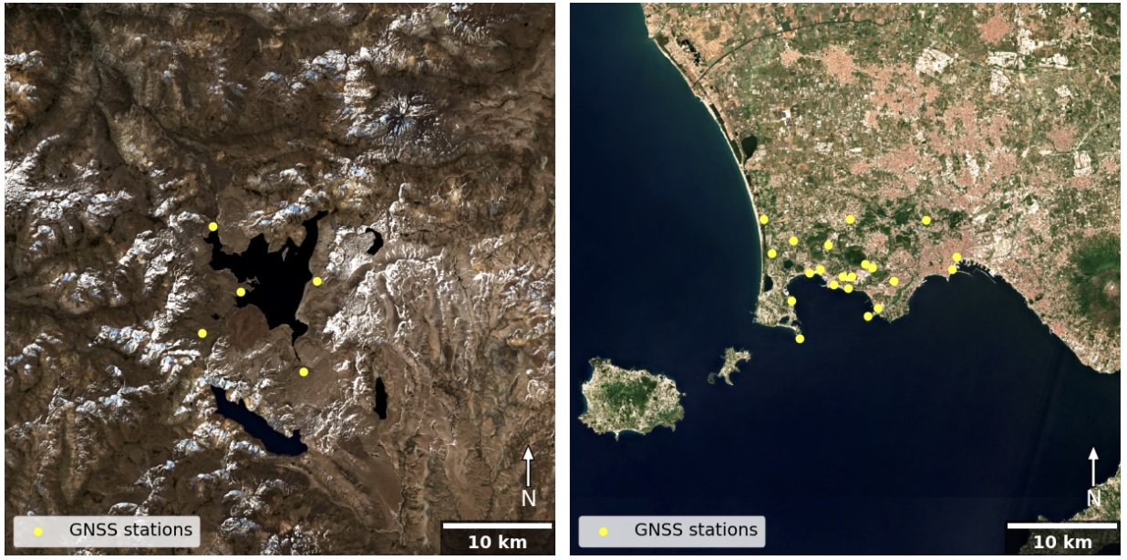
Synthetic magma-source deformation (1–4 Mogi sources, log₁₀ΔV ∈ [5, 7.9], depth 1.5–8 km) is superimposed on short-baseline (≤18 day) real interferograms, exposing the network to realistic atmosphere while keeping a known target.